Poland

Mazovia Province - Poland Case Study
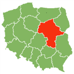
Masovian Voivodeship or Mazovia Province, is the largest and most populated of the 16 Polish provinces, created in 1999 and has 5.16 million inhabitants.
Mazovia is located in the Continental biographical region and the main soil type is light, sandy soils. It is a low-lying region with a climate characterised by warm summers and cool winters. It has a total size of 3,668,881 ha of which 2,190,256 ha is utilised agricultural area.
Key agricultural facts
Zealand Denmark | Eastern Scotland | Mazovia Poland | Közép Mag. Hungary | Toscany Italy | Jaén Spain | |
| Total number of farm holdings | 7.850 | 6.610 | 302.290 | 62.080 | 78.900 | 254.293 |
| Average farm size [ha] | 61 | 196 | 7 | 5 | 10 | 18 |
| Farm holdings < 5 ha [%] | 4 | 15 | 55 | 94 | 62 | 60 |
| Farm holdings > 50 ha[%] | 32 | 60 | 1 | 1 | 3 | 6 |
| Owner occupied[%] | 72 | 65 | 89 | 36 | 75 | 79 |
Source: Eurostat data, 2010
The average farm size in Mazovia is 7 ha, which is below the European Union average of 15 ha. A high proportion of the holdings are less than 5 ha (55%) with only 1% of holdings over 50 ha. 61% of the agricultural area is arable land and it is an important centre for horticulture, fruit growing and for the food-processing sector. It is dominated by small/medium scale cereal production and medium scale and high input orchards. Around 89% of the farmed land is owner occupied compared to an EU average of about 70%.