Work Package 1
Southern North Sea
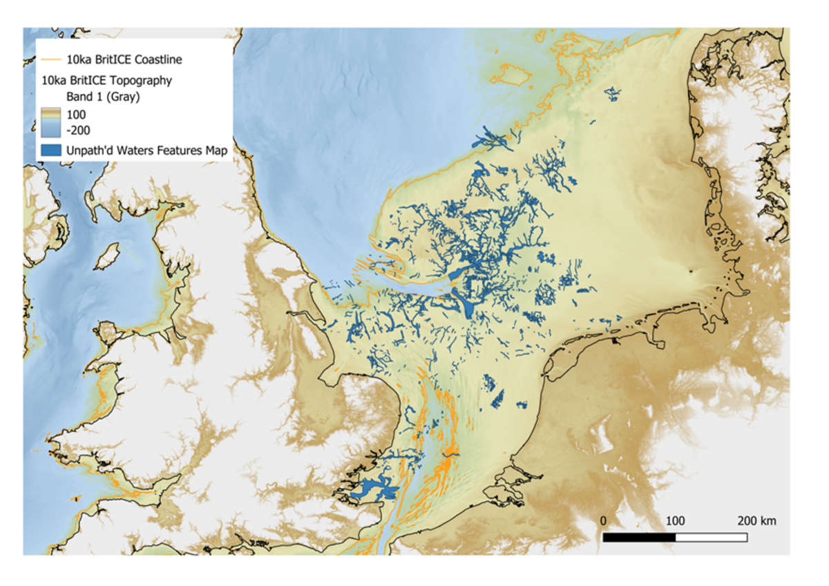
The southwestern area of the North Sea contains the remains of a vast landmass that connected modern continental Europe with the British Isles. Usually referred to as “Doggerland”, the area would have been a heartland of human occupation and central to the process of re-settlement and colonisation of north western Europe during the Palaeolithic and Mesolithic.
Global warming at the end of the last Ice Age led to the inundation of these lost lands. Today, the North Sea holds a unique and largely unexplored record of settlement and colonisation linked to climate change over millennia.. Access to the archaeology of this submerged landscape is hampered by deep water and thick modern sediments. Whilst archaeological evidence has been recovered from this unexplored area, these are largely chance finds, with limited potential for understanding the settlement of the landscape. This work package will seek to rectify this situation in two ways.
Initially, the work package will utilise artificial intelligence and simulation to explore the very large geophysical data sets available for this region and classify areas with archaeological potential, and to assess their accessibility to investigation.
The work package will also utilise data from the Dutch Flevoland Polder (FP) project to model and ground truth marine survey design to explore comparable submerged landscapes. The FP project has produced a large archive of landscape data relating to the deeply-buried early Holocene landscape on the Dutch mainland. These can be used as training sets for machine learning, to characterise and model archaeological indicators and landscape attributes of cultural activity for use further offshore and in deeper water- Following ground-truthing, WP1 will provide a new, high-resolution, 3D framework of the submerged landscape to support future exploration, facilitated through behavioural modelling and AI/Machine Learning processes. Replicable and ground-truthed, the process can be implemented across the areas of the European coastal shelf which have previously defied systematic exploration and in comparable landscapes globally.