Work Package 4


Southern Baltic
Impact of rising sea levels on coastal ecosystems and human ecodynamics
Along the southern Baltic Sea shore drowned landscapes are exceptionally well preserved. The wealth of Mesolithic archaeological sites in these landscapes is an outstanding characteristic of the region. They are often also associated with extensive, well-preserved remains of submerged coastal forests.
The combination of archaeological sites, woods and landscape features like former lakes are helping us to understand the larger picture of human stone age inhabitation on coasts and in the hinterland. The southern Baltic provides an opportunity to characterise surviving areas of the submerged landscape and their use by prehistoric communities alongside the evidence for settlement. The forested landscapes are of special interest because coastal sites with archaeological remains are often heavily affected by erosion associated with sea-level rise. Fallen trees can form sediment traps that protect palaeoenvironmental and cultural remains from damage and have been demonstrated to retain well preserved land surfaces.
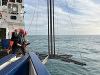
Work Package 4 will investigate the impact of rising sea levels on coastal ecosystems and human ecodynamics, by examining marine sediment sequences from preserved underwater land surfaces. Especially those associated with preserved forests, and incorporating faunal remains and archaeological records from submerged coastlines. Geophysical methods, underwater archaeological sampling and dendrochronological dating will provide multiproxy characterisations of early Holocene land surfaces and associated human activity. These proxies will be used in synergistic landscape and behavioural modelling across the project.
Detailed surveys of such areas, therefore, have the potential to locate optimal zones for archaeological exploration containing traces of human activity not usually found in terrestrial contexts.
Five specific test areas will be investigated in detail. We will be moving from well known areas where we can develop our models to less investigated ones to test these models. During field work we will be using remote sensing survey to identify landscape features, followed by coring of sediments and sedimentological, geochemical, palaeo- botanical and sedaDNA analyses as well as diving surveys. Dendrochronological samples supplemented by AMS 14C-dating, will provide a high-resolution chronology for modelling the former landscape and the coastal retreat in different time