
Mapping an ancient city with a century of remotely sensed data
New publication by David Stott, Søren Munch Kristiansen, Achim Lichtenberger, and Rubina Raja.
Stott, D., Kristiansen, S. M., Lichtenberger, A. & Raja, R. (2018). "Mapping an ancient city with a century of remotely sensed data", PNAS May 2018: e-pub ahead of print: https://doi.org/10.1073/pnas.1721509115.
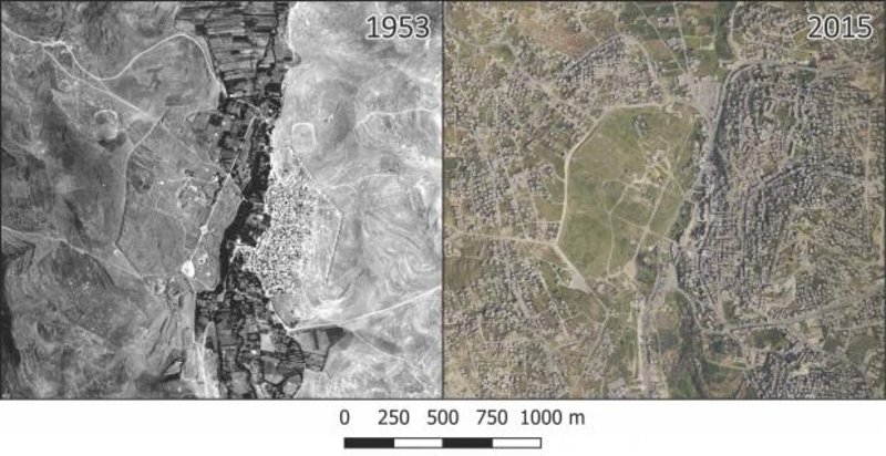
Within the framework of the Danish-German Jerash Northwest Quarter Project (directed by Achim Lichtenberger, Westfälische Wilhelms-Universität Münster, and Rubina Raja, Centre for Urban Network Evolutions, Aarhus University), a new publication has appeared, mapping for the first time ever in great detail archaeological and non-archaeological features of the ancient city Gerasa (modern-day Jerash in Northern Jordan), combining historical images with state-of-the-art multi-temporal aerial photography and modern airborne laser scanning.
The novelty of the approach is that it integrates unsharp World War I air-images, contemporary mm-precise laser scanning in 3 dimensions, and decades of scattered archaeological excavation data to produce a highly accurate map of how an entire ancient city in the Middle East appeared before modern destruction began. Such an environmentally non-invasive method is crucial to archaeological research and has significant implications for excavation planning and cultural heritage management worldwide, offering access to crucial and contextualised information about an area, with non-invasive methods and without destroying the archaeological structures and historical remains that hold this information. In many parts of the world, population growth and climate change pose urgent risks to cultural heritage sites, and archaeologists and cultural heritage workers are in a race against the clock to document and understand the life of past societies before the historical remains are irreversibly destroyed. Furthermore, these methods offer access to document multi-layer and multi-temporal sites, giving credit to all periods.
A number of previous studies on Gerasa have zoomed in on specific aspects of life in the ancient city, but so far, none have managed to paint an accurate ‘big picture’. In 2011, the Danish-German Jerash Northwest Quarter Project was initiated as a large-scale interdisciplinary excavation project with the aim of exploring the Northwest Quarter of the city. Since then, the project has systematically recorded evidence of the city’s urban development, and these most recent results – based on integrating historical aerial photos and modern technology – offer insights into the urban layout and infrastructure of Gerasa, including features related to the form and function of the city’s water management and the interaction between the city and its hinterland.
The directors and project members are excited about the prospects of this approach and will continue to refine methods and engage in knowledge exchange with local authorities and other stakeholders, hoping that remotely sensed data will henceforth serve as part of the basis for future research endeavours and management decisions.
Read also:
ScienceNordic: Once lost archaeology revealed by satellite images and aerial photography
Videnskab.dk, Forskerzonen: Gemte forhistoriske bysamfund er afdækket ved hjælp af billeder fra oven