![]()

![]()
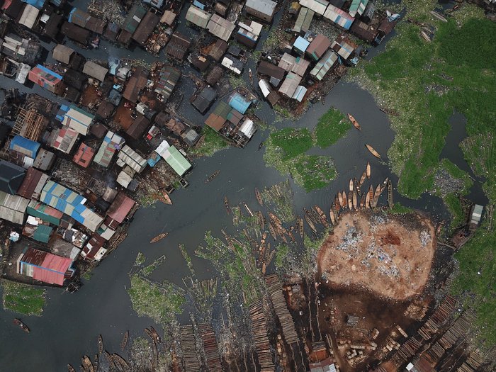
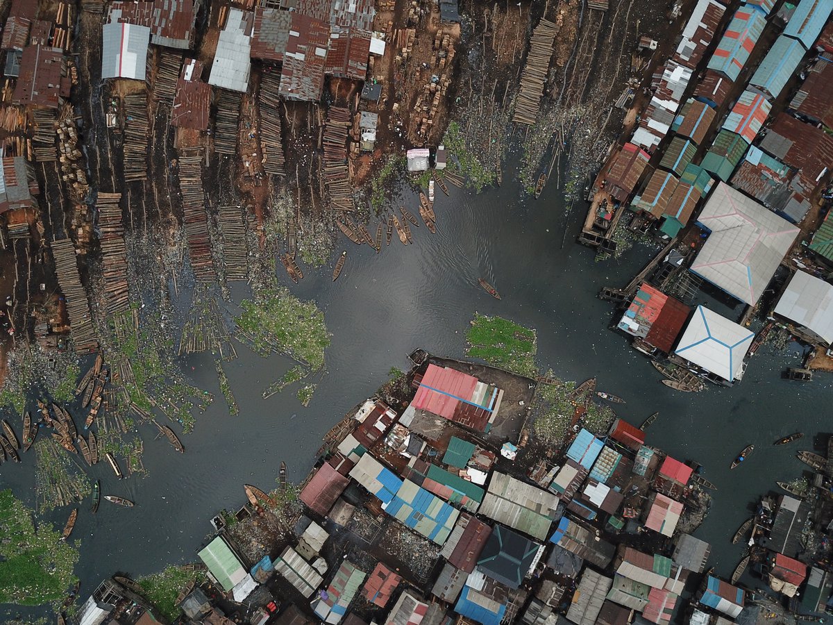
Makoko, a water-front settlement in the centre of Lagos, Nigeria, is estimated to be home to around 250,000 people, most of whom live in difficult conditions. Despite being only a few kilometers away from the financial center of the city, not far from the oil and gas companies’ headquarters in Victoria Island, the place used to be a blank spot on the map until recently.
A team at Code for Africa, a non-profit organisation working on civic technology and digital transformation in African countries, and its partners worked with the local community to create a bottom-up, open source map of the area using drones, smartphones, and crowdsourcing. Putting themselves on the map was a way for the community to state their right to exist.
The mapping project was captured in a flagship story produced by international media partners and is meant to be an ongoing process. In 2020 the project team returned to Makoko and conducted fresh water samples for analysis, mapping a further 20 clean water sources as POIs in Makoko. In 2021 two Nigerian medical researchers Dr Ayesha Akinkugbe from Lagos University Teaching Hospital and College of Medicine, University of Lagos and Dr Obianuju Ozoh from The Lagos University Teaching Hospital, in collaboration with Code for Africa’s Knowledge team, conducted scientific research on the ground. The research was to determine the enablers and barriers to the Covid-19 vaccine uptake in the Makoko informal settlement in Nigeria.
Organising interventions in Makoko on public health in a place where hundreds of thousands of people live without a map would be almost impossible. In a case like the COVID-19 pandemic or other epidemics, the map can be used as a tool by international organisations and also by the local government to organise support and distribute resources to the community, as proven by the University of Lagos (UNILAG) medical researchers who leveraged the Makoko’s open data and citizen science effort to conduct field research.
The partnership with UNILAG is particular remarkable and shows how a development project such as MapMakoko can leverage citizen science and feed into academic research.
Citizen science refers to the participation of members of the public in scientific research, either by collecting data or by contributing to scientific studies. In the case of MapMakoko, citizen science is evident in the involvement of the local population in the mapping process. The training sessions and mapping sessions had an impact on the scientific literacy of the population in multiple ways.
Firstly, by training the local population to use digital tools and drones to create the map, they were given the opportunity to develop skills that are relevant to scientific research. They learned about geospatial technology, mapping techniques, and data analysis. These skills are not only relevant to mapping a slum but are also transferable to other scientific fields. By gaining these skills, the local population is better equipped to participate in future scientific research projects.
Secondly, the involvement of the local population in the mapping process had a broader impact on scientific literacy in the community. By participating in the project, they were given the opportunity to learn about the importance of data and evidence-based decision making. They also gained an understanding of how scientific research can be used to address real-world problems and improve people's lives. This understanding of the value of scientific research can help to increase support for future scientific endeavors in the community.
This proves how a crowdsourced map can help propel academic research and proposes a new way of involving marginalised communities in scientific projects.
Author Credit: Jacopo Ottaviani
(MB)