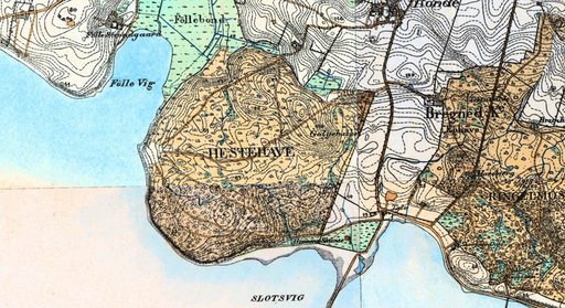
Hestehaven

The last ice transgression of Djursland and the formation of the East Jutlandic Stationary Line occurred about 14.000 years ago. During this glaciodynamic event the Tirstrup outwash plain was deposited by meltwater streams trending from east to west and north-west with drainage through Randers Fjord.
Mols Bjerge is a push moraine landscape formed in the interlobate area between the glacial tongues wich occupied Kalå Vig and Ebeltoft Vig. The moraine contains rafts of older glacial material and Tertiary clay dislocated by the ice from the south-east. The glaciotectonic structures are exposed along the coast of Mols Hoved. A sequence of glaciolacustrine sediments indicated a larger lake system which probably extended into the former Kattegat Area.
At the end of the Ice Age (10.000 years ago), the landscape was modified by stream erosion which deepened the valleys and formed smaller lakes. In the Early Atlantic, around 7.000 years ago, the valley systems were transgressed. Kolind Sund and Korup Sø formed the largest sites of marine deposition up to about 3.000 years ago.
In the final part of the Holocene large beach ridge systems were formed along the coasts. From north to the south there are Hevring Hede, Fjellerup Strand, the mouth of Kolind Sund at Grenå, Glatved, Dråby and Boeslum Strande, Gådehage, Ahl Plantage, Begstrup Vig, Akødshoved, and Dejret Øhoved.
In the lakes, the vegetation history is well documented and the development of forest can be followed from the early Holocene until the present day. In the former marine fjord and sound, peat bogs were widely developed towards the end of the Holocene.
Since the Iron Age, the northern part of Djursland has been influenced by Aeolian deposition.
A geological map of Djursland can be found elsewhere.
Hestehave Forest
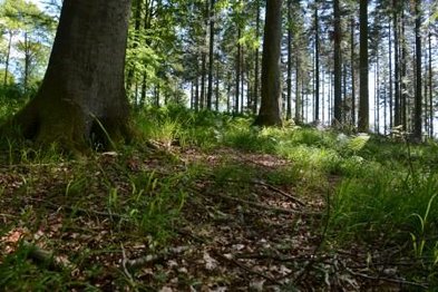
Hestehave forest is a part of Mols Bjerge landscape, which was formed in the last part of the Weichselian Ice Age by the Young Baltic Ice advance, about 16.000 years ago. The area is a push moraine landscape formed by the glacial tongues advancing from south through Kalø Vig and Ebeltoft Vig. North of the push moraine the meltwater has created a sandy meltwater plain – Tirstrup Hedeslette. The ice left an area dominated by clayey tills. The till contain chalk.
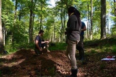
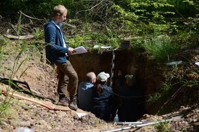
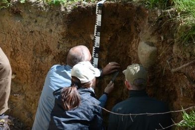
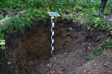
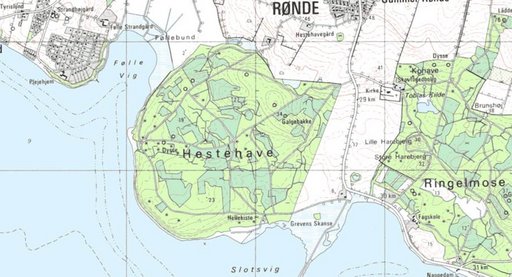
The soil profiles at Hestehave Forest are a topo-sequence showing the development of soil profiles from a chalk-containing clayey moraine from the last ice age. The topo-sequence consists of four soil profiles situated along a slope, as seen on the map below. The profile development is highly dependent on the topographic location of the profile. The profiles are developed on the same parent material.
FThe decomposition of organic material is rapid and only few recognizable plant remains are present on the surface and top soil. The profiles have been studies extensively, and chemical analysis of all profiles and horizons are available.
The Influence of Topography on the Development of Alfisols on Calcareous Calyey Till in Denmark (1981). Catena 8, 111-136
Pictures from field course June 2015