Presentations from workshop
Session 1 Soil Spectroscopy
Optimizing Model Development and Validation Procedures of Partial Least Squares for Spectral Based Prediction of Soil Properties |
Memory Based Learning: A New Data Mining Approach to Model and Interpret Clay Diffuse Reflectance Spectra |
Utilization of the Internal Soil Standard (ISS) Method to Optimize Exchange of Soil Spectral Libraries |
Session 2 Digital Soil Mapping of SOC
USDA CarbonScapes — A National Look at Carbon Landscapes and Meeting Place for the USDA Carbon Inventory and Modeling Community |
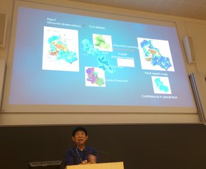
Coupling high resolution data and national baseline estimates for farm scale soil carbon auditing |
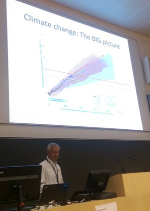
Global space-time soil carbon assessment |
A million dollar challenge to map peatlands in Indonesia |
Session 3 Digital Soil Mapping of SOC
3D modelling of Scottish soil properties |
Mapping Soil Organic Carbon Stocks Using a General 3D Mapping Approach in the Northeast Tibetan Plateau, China |
High resolution digital soil organic carbon mapping in Western Greenland |
Changes of soil organic matter stocks in Bavaria |
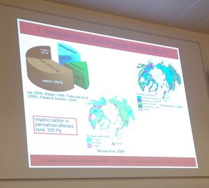
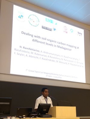
Soil organic carbon mapping at different scales in Madagascar |
Session 4 Digital Soil Mapping
Session 5 Digital Soil Mapping of large areas
Session 6 Digital Soil Mapping of large areas
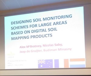
Designing soil monitoring schemes for large areas based on digital soil mapping products | |||
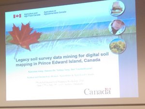
Legacy soil survey data mining for digital soil mapping in Prince Edward Island (PEI) province in Canada | |||
Applications of DSM for erosion modelling with uncertainty propagation
|
Session 7 Digital Soil Mapping
Predicting soil depth using survival analysis models |
An error budget for digital soil mapping using proximally sensed EM induction and remotely sensed g-ray spectrometer data |
Can citizen science be used to assist Digital Soil Mapping? |
Adaptation of public digital soil maps for practical use in agriculture |
Ensemble of topsoil texture predictions for Region Centre (France) |
Mapping of skidding track soil compaction and displacement from high resolution LIDAR-based DEM’s in broadleaved forest on poorly drained soils |
Scope to map soil management units at the district level from remotely sensed g-ray spectrometry and proximal sensed EM induction data |
Digital land resource mapping to address information and capacity shortages in developing countries |
Session 8 Digital Soil Mapping
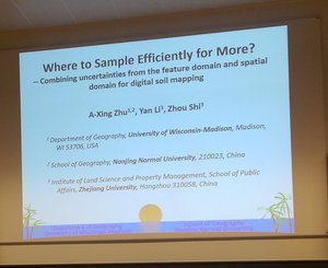
Combining uncertainties from the feature domain and spatial domain for digital soil mapping: where to sample more?
A-Xing Zhu, Yan Li and Zhou Shi
Digital soil mapping using data with different accuracy levels |
Accurate digital mapping of endemic soils |
Potential to map depth-specific soil organic matter content across an olive grove using quasi-2d and quasi-3d inversion of DUALEM-21 data |
Digital Soil Assessment of Landscape-Scale Forest Restoration Using a Species Distribution Model |
Mapping sustaining soils in prehispanic Western Mexico. Archaeopedology as a tool for understanding ancient agriculture |
Mapping of Functional Soil Classes across Scales |
Session 9 Remote Sensing and Soil Spectroscopy
Geographically closest resampling strategy for soil organic carbon and clay content prediction |
Identification of soil classes based on vis-NIR reflectance spectra using depth harmonization and machine learning techniques |
How reflectance spectroscopy can assist in soil classification? |
Using field spectroscopy in the VNIR-SWIR spectral region for predicting hydrophobicity level of undisturbed soils |
Multi-temporal composites of airborne imaging spectroscopy data for the use in digital soil mapping Mapping of land covers in South Greenland using very high resolution satellite imagery for SOC upscaling |
Session 10 Digital Soil Class Mapping
Mapping Drainage Classes in Denmark by Means of Decision Tree Classification |
Using regionalization maps in Digital Soil Mapping |
Multinomial Logistic Regression with soil diagnostic features and land surface parameters for soil mapping of Latium (Central Italy) |
Exploring effects of sampling approaches and quantities of training samples on updating conventional soil maps performance |
Session 11 Digital Soil Mapping and Environmental Covariates
Artificial Neural Networks for soil drainage class mapping in Denmark |
Development of environmental covariates for mapping soil properties over an alluvial plain |
Selection of principal stand factors as predictors for digital mapping |
Acid sulfate soil mapping in Denmark using legacy data and LiDAR-based derivatives |
Predicting Soil Processes: Digital Soil Mapping as a platform for bridging scale discrepancies between measurements and predictions |
Session 12 Digital Soil Mapping
The Role of Digital Soil Mapping in Transforming Agriculture: The Case of Ethiopian Soil Information System (EthioSIS) |
Classification and mapping of soil pH depth function groups for Denmark |
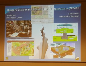
Object-oriented digital soil mapping for the support of Delineation of Areas with Natural Constraints in Hungary |
A new pH depth function for agricultural soils |