Lyngdal

The landscape in this area is to a very large degree formed by Quaternary glaciations. The area was covered by glaciers advanced from the north east. The ice had the largest extent during the Weichelian glaciation approximately 18000 BP advancing to the main stationary line 25km to the west of St. Lyngdal.
The glacial landscapes are a complex of irregular hills and mounds formed in contact with the glacier, ridges formed during the advanced of the ice and valleys formed by the meltwater below or in front of the glacier. Kettle holes are also common in the landscape. These are formed by blocks of melting ice left behind by the retreating ice.
The ridge on which the small plantation of St. Lyngdal are situated is a recessional push moraines formed by the glaciers during a relative short stationary period of the regression of the ice approximately 15000 BP.
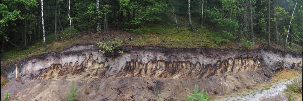
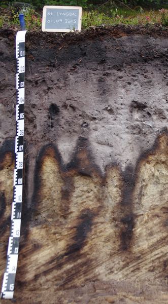
The soil profile is situated on the slope of a “spring valley” formed by water erosion coming from a spring in the foot slope of a valley (at the “start point” at figure 1). This spring creates this unique morphology of a spring valley by eroding back into the hills.